Union County, Indiana
Union County, Indiana | |
|---|---|
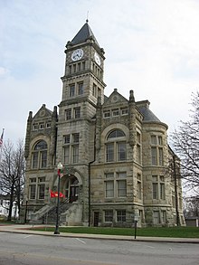 Union County Courthouse, Liberty | |
 Location in the U.S. state of Indiana | |
 Indiana's location in the U.S. | |
| Founded | 1821 |
| Seat | Liberty |
| Largest town | Liberty |
| Area | |
| • Total | 165.18 sq mi (428 km2) |
| • Land | 161.22 sq mi (418 km2) |
| • Water | 3.95 sq mi (10 km2), 2.39% |
| Population | |
| • (2010) | 7,516 |
| • Density | 46/sq mi (18/km2) |
| Congressional district | 6th |
| Time zone | Eastern: UTC−5/−4 |
| Website | www.unioncountyin.gov |
Footnotes: Indiana county number 81 | |

Liberty from the air, looking east.
Union County is a county located in the U.S. state of Indiana. As of 2010, the population was 7,516.[1] The county seat is Liberty.[2]
Contents
1 History
2 Geography
2.1 Adjacent counties
2.2 Cities and towns
2.3 Unincorporated
2.4 Townships
2.5 Major highways
3 Climate and weather
4 Government
5 Demographics
6 Education
7 Notable people
8 See also
9 References
History
Union County was formed in 1821. It was so named because it is the product of a union of parts of Fayette, Franklin and Wayne counties. The first settlers were from Laurens District, South Carolina. John Templeton was the first settler to enter land at the Cincinnati land office in what would become Harmony Township, Union County Indiana. The first county seat was Brownsville, a small town located on the East Fork of the Whitewater River. The seat was moved in 1824 to Liberty, a central location. The primary industry of Union County was and is farming.
Union County is the birthplace of Thomas Warren Bennett, Mary Alice Smith (Little Orphan Annie), Cincinnatus Hiner "Joaquin" Miller, Jay Hall Connaway, Major General Frederick Leroy Martin and Ambrose Burnside.
Geography
According to the 2010 census, the county has a total area of 165.18 square miles (427.8 km2), of which 161.22 square miles (417.6 km2) (or 97.60%) is land and 3.95 square miles (10.2 km2) (or 2.39%) is water.[3]
Adjacent counties
Wayne County (north)
Preble County, Ohio (east)
Butler County, Ohio (southeast)
Franklin County (south)
Fayette County (west)
Cities and towns
- Liberty
- West College Corner
Unincorporated
|
|
|
Townships
- Brownsville
- Center
- Harmony
- Harrison
- Liberty
- Union
Major highways
 U.S. Route 27
 Indiana State Road 44
 Indiana State Road 101
 Indiana State Road 227
Climate and weather
Liberty, Indiana | ||||||||||||||||||||||||||||||||||||||||||||||||||||||||||||
|---|---|---|---|---|---|---|---|---|---|---|---|---|---|---|---|---|---|---|---|---|---|---|---|---|---|---|---|---|---|---|---|---|---|---|---|---|---|---|---|---|---|---|---|---|---|---|---|---|---|---|---|---|---|---|---|---|---|---|---|---|
| Climate chart (explanation) | ||||||||||||||||||||||||||||||||||||||||||||||||||||||||||||
| ||||||||||||||||||||||||||||||||||||||||||||||||||||||||||||
| ||||||||||||||||||||||||||||||||||||||||||||||||||||||||||||
In recent years, average temperatures in Liberty have ranged from a low of 17 °F (−8 °C) in January to a high of 87 °F (31 °C) in July, although a record low of −31 °F (−35 °C) was recorded in January 1994 and a record high of 104 °F (40 °C) was recorded in September 1951. Average monthly precipitation ranged from 2.68 inches (68 mm) in September to 4.90 inches (124 mm) in May.[4]
Government
The county government is a constitutional body, and is granted specific powers by the Constitution of Indiana, and by the Indiana Code.
County Council: The county council is the legislative branch of the county government and controls all the spending and revenue collection in the county. Representatives are elected from county districts. The council members serve four-year terms. They are responsible for setting salaries, the annual budget, and special spending. The council also has limited authority to impose local taxes, in the form of an income and property tax that is subject to state level approval, excise taxes, and service taxes.[5][6]
Board of Commissioners: The executive body of the county is made of a board of commissioners. The commissioners are elected county-wide, in staggered terms, and each serves a four-year term. One of the commissioners, typically the most senior, serves as president. The commissioners are charged with executing the acts legislated by the council, collecting revenue, and managing the day-to-day functions of the county government.[5][6]
Court: The county maintains a circuit court that can handle all case types. The judge on the court is elected to a term of four years and must be a member of the Indiana Bar Association. In some cases, court decisions can be appealed to the state level appeals court.[6]
County Officials: The county has several other elected offices, including sheriff, coroner, auditor, treasurer, recorder, surveyor, and circuit court clerk. Each of these elected officers serves a term of four years and oversees a different part of county government. People elected to county government positions are required to be residents of the county.[6]
| Year | Republican | Democratic | Third parties |
|---|---|---|---|
2016 | 74.3% 2,445 | 21.7% 715 | 4.0% 131 |
2012 | 65.1% 2,022 | 32.8% 1,018 | 2.1% 64 |
2008 | 61.4% 2,061 | 36.5% 1,224 | 2.1% 70 |
2004 | 67.8% 2,266 | 31.3% 1,045 | 1.0% 33 |
2000 | 65.0% 1,838 | 32.8% 927 | 2.2% 63 |
1996 | 48.9% 1,334 | 37.3% 1,019 | 13.8% 377 |
1992 | 47.0% 1,394 | 30.3% 898 | 22.8% 676 |
1988 | 65.5% 1,814 | 34.2% 946 | 0.4% 10 |
1984 | 70.4% 1,970 | 29.1% 816 | 0.5% 14 |
1980 | 63.5% 1,766 | 32.3% 898 | 4.2% 116 |
1976 | 58.3% 1,631 | 41.4% 1,160 | 0.3% 9 |
1972 | 72.5% 2,043 | 27.2% 765 | 0.4% 10 |
1968 | 56.0% 1,691 | 30.5% 920 | 13.5% 408 |
1964 | 51.0% 1,531 | 48.7% 1,463 | 0.4% 11 |
1960 | 63.7% 2,087 | 36.0% 1,180 | 0.2% 8 |
1956 | 63.5% 2,026 | 36.3% 1,157 | 0.3% 9 |
1952 | 67.2% 2,159 | 32.1% 1,029 | 0.7% 23 |
1948 | 63.3% 1,859 | 35.7% 1,049 | 1.1% 31 |
1944 | 63.1% 1,998 | 36.4% 1,154 | 0.5% 17 |
1940 | 58.4% 2,009 | 41.1% 1,415 | 0.6% 19 |
1936 | 49.2% 1,630 | 50.2% 1,662 | 0.6% 21 |
1932 | 50.4% 1,658 | 48.3% 1,587 | 1.3% 44 |
1928 | 66.0% 2,101 | 33.6% 1,069 | 0.4% 14 |
1924 | 58.8% 1,907 | 39.6% 1,284 | 1.7% 54 |
1920 | 58.3% 1,984 | 40.4% 1,375 | 1.3% 44 |
1916 | 53.0% 997 | 43.9% 826 | 3.2% 60 |
1912 | 35.9% 643 | 39.3% 705 | 24.8% 444 |
1908 | 54.3% 1,066 | 41.1% 808 | 4.6% 91 |
1904 | 57.5% 1,156 | 37.7% 758 | 4.8% 96 |
1900 | 52.7% 1,060 | 44.6% 897 | 2.7% 55 |
1896 | 54.1% 1,118 | 44.3% 915 | 1.7% 35 |
1892 | 51.8% 981 | 44.3% 839 | 3.9% 74 |
1888 | 54.7% 1,108 | 42.9% 868 | 2.4% 48 |
Demographics
| Historical population | |||
|---|---|---|---|
| Census | Pop. | %± | |
| 1830 | 7,944 | — | |
| 1840 | 8,017 | 0.9% | |
| 1850 | 6,944 | −13.4% | |
| 1860 | 7,109 | 2.4% | |
| 1870 | 6,341 | −10.8% | |
| 1880 | 7,673 | 21.0% | |
| 1890 | 7,006 | −8.7% | |
| 1900 | 6,748 | −3.7% | |
| 1910 | 6,260 | −7.2% | |
| 1920 | 6,021 | −3.8% | |
| 1930 | 5,880 | −2.3% | |
| 1940 | 6,017 | 2.3% | |
| 1950 | 6,412 | 6.6% | |
| 1960 | 6,457 | 0.7% | |
| 1970 | 6,582 | 1.9% | |
| 1980 | 6,860 | 4.2% | |
| 1990 | 6,976 | 1.7% | |
| 2000 | 7,349 | 5.3% | |
| 2010 | 7,516 | 2.3% | |
| Est. 2016 | 7,212 | [8] | −4.0% |
| U.S. Decennial Census[9] 1790-1960[10] 1900-1990[11] 1990-2000[12] 2010-2013[1] | |||
As of the 2010 United States Census, there were 7,516 people, 2,938 households, and 2,117 families residing in the county.[13] The population density was 46.6 inhabitants per square mile (18.0/km2). There were 3,239 housing units at an average density of 20.1 per square mile (7.8/km2).[3] The racial makeup of the county was 97.5% white, 0.4% black or African American, 0.3% Asian, 0.3% American Indian, 0.1% Pacific islander, 0.3% from other races, and 1.1% from two or more races. Those of Hispanic or Latino origin made up 1.1% of the population.[13] In terms of ancestry, 26.2% were German, 16.0% were Irish, 11.9% were English, and 11.6% were American.[14]
Of the 2,938 households, 34.4% had children under the age of 18 living with them, 56.0% were married couples living together, 11.7% had a female householder with no husband present, 27.9% were non-families, and 23.9% of all households were made up of individuals. The average household size was 2.54 and the average family size was 2.99. The median age was 40.3 years.[13]
The median income for a household in the county was $47,697 and the median income for a family was $49,815. Males had a median income of $39,603 versus $27,394 for females. The per capita income for the county was $19,243. About 8.2% of families and 11.9% of the population were below the poverty line, including 21.2% of those under age 18 and 10.0% of those age 65 or over.[15]
Education
Union County is served by the Union County–College Corner Joint School District, the only joint state school district in the state.
Notable people
Ambrose Everett Burnside, American soldier, railroad executive, inventor, industrialist, and politician
Thomas W. Bennett (territorial governor), governor of Idaho Territory 1871-1875; born in Union County.[16]
Hiram Rhodes Revels, first African-American member of the US Senate, representing Mississippi 1870-1871; attended the Union County Quaker Seminary.- Bill Bartlett, Former Guitarist for Ram Jam
Jay Hall Connaway , Realist Painter- Mary Alice Smith , aka Little Orphant Annie
Bob Jenkins, former television and radio sports announcer for ESPN/ABC Sports
See also
- National Register of Historic Places listings in Union County, Indiana
Edward E. Moore, Indiana state senator and Los Angeles City Council member
References
^ ab "Union County QuickFacts". United States Census Bureau. Retrieved 2011-09-25..mw-parser-output cite.citation{font-style:inherit}.mw-parser-output q{quotes:"""""""'""'"}.mw-parser-output code.cs1-code{color:inherit;background:inherit;border:inherit;padding:inherit}.mw-parser-output .cs1-lock-free a{background:url("//upload.wikimedia.org/wikipedia/commons/thumb/6/65/Lock-green.svg/9px-Lock-green.svg.png")no-repeat;background-position:right .1em center}.mw-parser-output .cs1-lock-limited a,.mw-parser-output .cs1-lock-registration a{background:url("//upload.wikimedia.org/wikipedia/commons/thumb/d/d6/Lock-gray-alt-2.svg/9px-Lock-gray-alt-2.svg.png")no-repeat;background-position:right .1em center}.mw-parser-output .cs1-lock-subscription a{background:url("//upload.wikimedia.org/wikipedia/commons/thumb/a/aa/Lock-red-alt-2.svg/9px-Lock-red-alt-2.svg.png")no-repeat;background-position:right .1em center}.mw-parser-output .cs1-subscription,.mw-parser-output .cs1-registration{color:#555}.mw-parser-output .cs1-subscription span,.mw-parser-output .cs1-registration span{border-bottom:1px dotted;cursor:help}.mw-parser-output .cs1-hidden-error{display:none;font-size:100%}.mw-parser-output .cs1-visible-error{font-size:100%}.mw-parser-output .cs1-subscription,.mw-parser-output .cs1-registration,.mw-parser-output .cs1-format{font-size:95%}.mw-parser-output .cs1-kern-left,.mw-parser-output .cs1-kern-wl-left{padding-left:0.2em}.mw-parser-output .cs1-kern-right,.mw-parser-output .cs1-kern-wl-right{padding-right:0.2em}
^ "Find a County". National Association of Counties. Retrieved 2011-06-07.
^ ab "Population, Housing Units, Area, and Density: 2010 - County". United States Census Bureau. Retrieved 2015-07-10.
^ ab "Monthly Averages for Liberty, Indiana". The Weather Channel. Retrieved 2011-01-27.
^ ab Indiana Code. "Title 36, Article 2, Section 3". IN.gov. Retrieved 2008-09-16.
^ abcd Indiana Code. "Title 2, Article 10, Section 2" (PDF). IN.gov. Retrieved 2008-09-16.
^ Leip, David. "Dave Leip's Atlas of U.S. Presidential Elections". uselectionatlas.org. Retrieved 2018-05-20.
^ "Population and Housing Unit Estimates". Retrieved June 9, 2017.
^ "U.S. Decennial Census". United States Census Bureau. Retrieved July 10, 2014.
^ "Historical Census Browser". University of Virginia Library. Retrieved July 10, 2014.
^ "Population of Counties by Decennial Census: 1900 to 1990". United States Census Bureau. Retrieved July 10, 2014.
^ "Census 2000 PHC-T-4. Ranking Tables for Counties: 1990 and 2000" (PDF). United States Census Bureau. Retrieved July 10, 2014.
^ abc "DP-1 Profile of General Population and Housing Characteristics: 2010 Demographic Profile Data". United States Census Bureau. Retrieved 2015-07-10.
^ "DP02 SELECTED SOCIAL CHARACTERISTICS IN THE UNITED STATES – 2006-2010 American Community Survey 5-Year Estimates". United States Census Bureau. Retrieved 2015-07-10.
^ "DP03 SELECTED ECONOMIC CHARACTERISTICS – 2006-2010 American Community Survey 5-Year Estimates". United States Census Bureau. Retrieved 2015-07-10.
^ "BENNETT, Thomas Warren, (1831 - 1893)". Biographical Directory of the United States Congress. Retrieved September 16, 2012.
Places adjacent to Union County, Indiana | ||||||||||
|---|---|---|---|---|---|---|---|---|---|---|
| ||||||||||
Municipalities and communities of Union County, Indiana, United States | ||
|---|---|---|
County seat: Liberty | ||
| Towns |
| |
| Townships |
| |
| Unincorporated communities |
| |
Indianapolis (capital) | ||
| Topics |
|  Seal of Indiana |
| Society |
| |
| Regions |
| |
| Largest cities |
| |
| Largest towns |
| |
| Counties |
| |
Coordinates: 39°37′N 84°55′W / 39.62°N 84.92°W / 39.62; -84.92


