French River (Massachusetts)
Coordinates: 42°01′27″N 71°53′03″W / 42.0243°N 71.8841°W / 42.0243; -71.8841

French River and environs
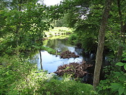
French River south of West Main Street, Hodges Village, Oxford, Massachusetts
The French River is a river in south-central Massachusetts and northeastern Connecticut, USA.
The river rises near Leicester, Massachusetts, and flows generally southwards through Auburn, Oxford, and along the town line between Webster and Dudley; it then enters Connecticut where it joins the Quinebaug River at Thompson, just northeast of Putnam. The Quinebaug in turn flows into the Shetucket River and ultimately the Thames River to empty into the Long Island Sound.
The river's total length is 25.3 miles (40.7 km), of which 18.8 miles (30.3 km) are in Massachusetts.[1] It drains a watershed area of about 95 square miles (250 km2), containing 67 lakes and ponds, 38 of which cover at least 10 acres (4.0 ha). Only one lake in its basin is larger than 500 acres (200 ha), namely Lake Chaubunagungamaug (Webster Lake) in Webster, Massachusetts at 1,195 acres (484 ha).
French River was so named from a settlement of French Protestants in Oxford.[2]
See also
- List of rivers of Connecticut
- List of rivers of Massachusetts
References
^ U.S. Geological Survey. National Hydrography Dataset high-resolution flowline data. The National Map Archived 2012-04-05 at WebCite, accessed April 1, 2011
^ Gannett, Henry (1905). The Origin of Certain Place Names in the United States. Govt. Print. Off. p. 132..mw-parser-output cite.citation{font-style:inherit}.mw-parser-output q{quotes:"""""""'""'"}.mw-parser-output code.cs1-code{color:inherit;background:inherit;border:inherit;padding:inherit}.mw-parser-output .cs1-lock-free a{background:url("//upload.wikimedia.org/wikipedia/commons/thumb/6/65/Lock-green.svg/9px-Lock-green.svg.png")no-repeat;background-position:right .1em center}.mw-parser-output .cs1-lock-limited a,.mw-parser-output .cs1-lock-registration a{background:url("//upload.wikimedia.org/wikipedia/commons/thumb/d/d6/Lock-gray-alt-2.svg/9px-Lock-gray-alt-2.svg.png")no-repeat;background-position:right .1em center}.mw-parser-output .cs1-lock-subscription a{background:url("//upload.wikimedia.org/wikipedia/commons/thumb/a/aa/Lock-red-alt-2.svg/9px-Lock-red-alt-2.svg.png")no-repeat;background-position:right .1em center}.mw-parser-output .cs1-subscription,.mw-parser-output .cs1-registration{color:#555}.mw-parser-output .cs1-subscription span,.mw-parser-output .cs1-registration span{border-bottom:1px dotted;cursor:help}.mw-parser-output .cs1-hidden-error{display:none;font-size:100%}.mw-parser-output .cs1-visible-error{font-size:100%}.mw-parser-output .cs1-subscription,.mw-parser-output .cs1-registration,.mw-parser-output .cs1-format{font-size:95%}.mw-parser-output .cs1-kern-left,.mw-parser-output .cs1-kern-wl-left{padding-left:0.2em}.mw-parser-output .cs1-kern-right,.mw-parser-output .cs1-kern-wl-right{padding-right:0.2em}
- USGS French River Basin
- Massachusetts Executive Department of Environmental Affairs
This article related to a river in Massachusetts is a stub. You can help Wikipedia by expanding it. |
This article related to a river in Connecticut is a stub. You can help Wikipedia by expanding it. |


