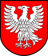
Tyszowce
Tyszowce | ||
|---|---|---|
 | ||
| ||
 Tyszowce Show map of Lublin Voivodeship  Tyszowce Show map of Poland | ||
| Coordinates: 50°37′6″N 23°42′35″E / 50.61833°N 23.70972°E / 50.61833; 23.70972 | ||
| Country | ||
| Voivodeship | ||
| County | Tomaszów Lubelski | |
| Gmina | Tyszowce | |
| Government | ||
| • Mayor | Mariusz Zając | |
| Area | ||
| • Total | 18.52 km2 (7.15 sq mi) | |
| Population (2006) | ||
| • Total | 242 | |
| • Density | 13/km2 (34/sq mi) | |
| Time zone | UTC+1 (CET) | |
| • Summer (DST) | UTC+2 (CEST) | |
| Postal code | 22-630 | |
| Website | https://web.archive.org/web/20070812230834/http://www.tyszowce.bip.lublin.pl/ | |
Tyszowce [tɨˈʂɔft͡sɛ] (Yiddish: טישעוויץ Tishevitz) is a town (since January 1, 2000) in Tomaszów Lubelski County, Lublin Voivodeship, Poland, with 359 inhabitants (2004). Tyszowce was incorporated as a town from 1419 until 1870 when it lost its city charter, to regain it only in 2000. In 1655 the Tyszowce Confederation was formed here.
Contents
1 History
2 Jewish Community
3 External links
4 References
History
The history of Tyszowce dates back to the Middle Ages, when a gord probably existed among swampy meadows of the Huczwa river. Following the Mongol Invasion of Poland, in which most local towns were burned to the ground, Tyszowce emerged as a center of trade and administration, at the expense of the destroyed town of Czermno. By the 15th century, Tyszowce had the status of a ducal town, with Magdeburg rights granted to it probably in the early 14th century by Siemowit IV, Duke of Masovia. The charter was confirmed in 1453 by Duke of Belz, Wladyslaw I.
In 1462, the Duchy of Belz was incorporated into the Kingdom of Poland, and renamed into Belz Voivodeship. Tyszowce was named a royal town, and a starostwo was created, consisting of the town itself, and four local villages. In 1500, Tyszowce was destroyed in a Crimean Tatar raid; the destruction was so widespread that for the next 10 years no taxes were collected.
In the period known as Polish Golden Age, Tyszowce began to prosper, together with whole Polish-Lithuanian Commonwealth. Some time in the early 16th century, a castle was constructed, which served as a residence of the starosta. The castle was probably wooden, located in the outskirts of the town, and was first mentioned in documents from 1564. Tyszowce was at that time protected by an earth rampart, reinforced with wood. These fortifications were destroyed during the mid-17th-century wars.
In the early 17th century, Tyszowce was raided by Tatars, and in 1649, the town was destroyed during the Khmelnytsky Uprising. Further destruction took place in the 1650s, when Tyszowce was ransacked by Cossacks, Russians and Tatars. On December 29, 1655, the Tyszowce Confederation was signed here, with the purpose of pushing Swedes out of Poland, and bringing back King Jan Kazimierz Waza. The document was signed by Hetmans Stanislaw Potocki and Stanislaw Lanckoronski, as well as several senators, military leaders and members of nobility.
In 1767, Tyszowce became private property, and five years later, following the first partition of Poland, the town was annexed by the Habsburg Empire, as part of Austrian Galicia. Its population was divided between 200 Christian and 80 Jewish families.
In 1803, Tyszowce burned in a great fire, and since 1815 until 1916, the town belonged to Russian-controlled Congress Poland. In 1847, its population reached almost 3,000, divided between Roman Catholics, Greek Catholics and Jews, and Tyszowce remained a private property of the Glogowski family. In 1869, Russian authorities stripped Tyszowce of its town charter, as a revenge for widespread support of the January Uprising (on May 18, 1863, the town was seized by rebel forces).
In 1907 Tyszowce burned again, and in 1910, population of the village reached its maximum, at 7,620. Tyszowce suffered during World War I, it was destroyed, and by 1921, population was reduced to 4,420, including 1,592 Poles, 177 Ukrainians and 2,451 Jews. During World War II, 60% of Tyszowce was destroyed.
Jewish Community
The Jewish population numbered 2,454 Jews in 1921. In October, 1939 the village was occupied by the Nazis. About 1,000 Jews fled across the Bug River to the Soviet Union. In 1940, a forced labor camp was established in Tyszowce. During the night of April 16, 1942, the Nazis launched a massive execution of Jews in Tyszowce. Jews were brought to the square before the former public bath, where several hundred Jews were shot. The Nazis threw the corpses into a ditch. In 1942, about 2,000 Jews altogether, including some from Czechoslovakia, were deported to the Bełżec extermination camp. Another 150 Tyszowce Jews were deported to the Zamość labor camp.[1] According to some sources, between June 1942 and the end of 1943, approximately 1,000 Jews from Tyszowce and surrounding towns were executed.[2]
External links
- Official town webpage
References
^ "Remember Jewish Tyszowce". 2013-05-09..mw-parser-output cite.citation{font-style:inherit}.mw-parser-output q{quotes:"""""""'""'"}.mw-parser-output code.cs1-code{color:inherit;background:inherit;border:inherit;padding:inherit}.mw-parser-output .cs1-lock-free a{background:url("//upload.wikimedia.org/wikipedia/commons/thumb/6/65/Lock-green.svg/9px-Lock-green.svg.png")no-repeat;background-position:right .1em center}.mw-parser-output .cs1-lock-limited a,.mw-parser-output .cs1-lock-registration a{background:url("//upload.wikimedia.org/wikipedia/commons/thumb/d/d6/Lock-gray-alt-2.svg/9px-Lock-gray-alt-2.svg.png")no-repeat;background-position:right .1em center}.mw-parser-output .cs1-lock-subscription a{background:url("//upload.wikimedia.org/wikipedia/commons/thumb/a/aa/Lock-red-alt-2.svg/9px-Lock-red-alt-2.svg.png")no-repeat;background-position:right .1em center}.mw-parser-output .cs1-subscription,.mw-parser-output .cs1-registration{color:#555}.mw-parser-output .cs1-subscription span,.mw-parser-output .cs1-registration span{border-bottom:1px dotted;cursor:help}.mw-parser-output .cs1-hidden-error{display:none;font-size:100%}.mw-parser-output .cs1-visible-error{font-size:100%}.mw-parser-output .cs1-subscription,.mw-parser-output .cs1-registration,.mw-parser-output .cs1-format{font-size:95%}.mw-parser-output .cs1-kern-left,.mw-parser-output .cs1-kern-wl-left{padding-left:0.2em}.mw-parser-output .cs1-kern-right,.mw-parser-output .cs1-kern-wl-right{padding-right:0.2em}
^ "Execution Sites of Jewish Victims Investigated by Yahad-In Unum". Yahad Map. Retrieved 18 December 2014.
Coordinates: 50°37′N 23°42′E / 50.617°N 23.700°E / 50.617; 23.700

