Biên Hòa
Biên Hòa Thành phố Biên Hòa | |
|---|---|
City (Class-1) | |
| Biên Hòa City | |
 Biên Hòa Location of in Vietnam | |
| Coordinates: 10°57′N 106°49′E / 10.950°N 106.817°E / 10.950; 106.817 | |
| Country | |
| Province | Đồng Nai |
| Area | |
| • Total | 264,08 km2 (10,196 sq mi) |
| Population (2015) | |
| • Total | 1,104,495 |
| • Density | 4,182/km2 (10,830/sq mi) |
| Climate | Aw |
Biên Hòa (Northern accent: ![]() listen, Southern accent:
listen, Southern accent: ![]() listen) is a city in Đồng Nai Province, Vietnam, about 30 kilometres (20 mi) east of Hồ Chí Minh City (formerly Saigon), to which Biên Hòa is linked by Vietnam Highway 1.
listen) is a city in Đồng Nai Province, Vietnam, about 30 kilometres (20 mi) east of Hồ Chí Minh City (formerly Saigon), to which Biên Hòa is linked by Vietnam Highway 1.
Contents
1 Administrative divisions
2 Demographics
3 History
3.1 Before and during the Nguyen Dynasty
3.2 Republic of Vietnam
3.3 Socialist Republic
4 Economic
5 Transport
6 Sister cities
7 See also
8 References
Administrative divisions
Demographics
In 1989 the estimated population was 273,879. In 1999, the population was 435,400. 701,194 in 2009.[1] In December 2012, the population of the city crossed the one million mark.[2]
History
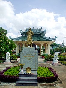
Nguyễn Hữu Cảnh temple in Cù Lao Phố.

Trấn Biên Temple of Literature, a Vietnamese Confucian temple.
Before and during the Nguyen Dynasty
The area around Biên Hòa was part of small kingdom prior to being annexed by Chenla. It was an agricultural and fishing region.
The capture of Biên Hòa on December 16, 1861 was an important allied victory in the Cochinchina Campaign (1858–62). This campaign, fought between the French and the Spanish on the one side and the Vietnamese (under the Nguyen Dynasty) on the other, began as a limited punitive expedition and ended as a French war of conquest. The war concluded with the establishment of the French colony of Cochinchina, a development that inaugurated nearly a century of French colonial dominance in Vietnam.
Republic of Vietnam
Biên Hòa grew into a major suburb of Saigon as the capital city of the Republic of (South) Vietnam grew. Following the First Indochina War, tens of thousands of refugees from the northern and central regions of Vietnam—a large portion of whom were Roman Catholics — resettled in Biên Hòa as part of Operation Passage to Freedom. During the Vietnam War, the United States Air Force operated Bien Hoa Air Base near the city. Mortar attacks on U.S. and ARVN targets were frequently staged from residential districts in Biên Hòa. Two of the better-known attacks took place during Tet of 1968 as well as 1969.[3]
Socialist Republic
Like most other areas of Vietnam, post-war Biên Hòa suffered a period of severe economic decline between 1975 and the second half of the 1980s. In part, because of its high concentration of former refugees and their descendants who had fled the Communist government of North Vietnam in the mid-1950s, Biên Hòa was the site of small-scale resistance to the Communist government in the months immediately following the fall of the Republic of Vietnam.
In the 1980s, the government of the Socialist Republic of Vietnam initiated the economic reform policy of Đổi Mới[clarification needed] and Biên Hòa experienced an economic resurgence. Biên Hòa and the surrounding areas received large amounts of foreign investment capital, and the area rapidly industrialized.[citation needed]
As of 2005[update], Biên Hòa is now an industrial center of southern Vietnam, and many factories and warehouses (often funded in collaboration with Japanese, Singaporean, American, Swiss and other foreign investors) operate in the area surrounding the city. Bien Hoa Sugar is located near the city.
With regard to entertainment, the city includes several amusement parks, nightclubs and restaurants lining the Đồng Nai River. Construction has increased rapidly (with many Western-style houses and villas under development), and the real estate market has experienced a series of boom cycles since the mid-1990s.[citation needed]
Biên Hòa also is the location of the Biên Hòa Military Cemetery, a large national cemetery for fallen soldiers and military officials of the former Republic of Vietnam (ARVN). The cemetery today is now neglected by the current communist regime, and many sections of the cemetery are either vandalized, or demolished for the construction of various building projects. Most of the time there was no proper reburial for the skeletal remains, and this caused an outcry by Overseas Vietnamese, most of whom came from the South.[4] The Vietnamese America Foundation, and its program called "The Returning Casualty" are attempting to restore the cemetery and excavate a nearby mass grave.[5]
Economic
Bien Hoa is the central of Industry in South Viet Nam. About 6 industrial Zone
- Bien Hoa I Industrial Zone 335 ha
- Bien Hoa II Industrial Zone 365 ha
- Amata industrial park 674 ha
- The Long Binh Industrial Zone Development
- Agtex Long Binh Industrial Park - AGTEX 28: 43 ha
- Tam Phuoc Industrial Park 323 ha
Transport
Hồ Chí Minh Bridge leads out of the south of the city.
Biên Hòa Railway Station on the North–South Railway is available.
Sister cities
Vinh (Viet Nam)
See also
| Wikimedia Commons has media related to Bien Hoa. |
- Trấn Biên Literature Temple
- Bien Hoa Air Base
- Đồng Nai Bridge
References
^ http://www.gso.gov.vn/Modules/Doc_Download.aspx?DocID=12724
^ Chào mừng Hội nghị hiệp hội các đô thị Việt Nam diễn ra tại thành phố Biên Hòa — Trang thông tin điện tử thành phố Biên Hòa Archived November 26, 2013, at the Wayback Machine.
^ Pike, Thomas F., Operations & Intelligence, III Corps Reporting: Tet 1969, 2016, .mw-parser-output cite.citation{font-style:inherit}.mw-parser-output q{quotes:"""""""'""'"}.mw-parser-output code.cs1-code{color:inherit;background:inherit;border:inherit;padding:inherit}.mw-parser-output .cs1-lock-free a{background:url("//upload.wikimedia.org/wikipedia/commons/thumb/6/65/Lock-green.svg/9px-Lock-green.svg.png")no-repeat;background-position:right .1em center}.mw-parser-output .cs1-lock-limited a,.mw-parser-output .cs1-lock-registration a{background:url("//upload.wikimedia.org/wikipedia/commons/thumb/d/d6/Lock-gray-alt-2.svg/9px-Lock-gray-alt-2.svg.png")no-repeat;background-position:right .1em center}.mw-parser-output .cs1-lock-subscription a{background:url("//upload.wikimedia.org/wikipedia/commons/thumb/a/aa/Lock-red-alt-2.svg/9px-Lock-red-alt-2.svg.png")no-repeat;background-position:right .1em center}.mw-parser-output .cs1-subscription,.mw-parser-output .cs1-registration{color:#555}.mw-parser-output .cs1-subscription span,.mw-parser-output .cs1-registration span{border-bottom:1px dotted;cursor:help}.mw-parser-output .cs1-hidden-error{display:none;font-size:100%}.mw-parser-output .cs1-visible-error{font-size:100%}.mw-parser-output .cs1-subscription,.mw-parser-output .cs1-registration,.mw-parser-output .cs1-format{font-size:95%}.mw-parser-output .cs1-kern-left,.mw-parser-output .cs1-kern-wl-left{padding-left:0.2em}.mw-parser-output .cs1-kern-right,.mw-parser-output .cs1-kern-wl-right{padding-right:0.2em}
ISBN 978-1-534-79903-5, pp 91-103.
^ "The Returning Casualty Blog » Bien Hoa Cemetery: The Last of Its Kind in Vietnam". Vietremains.org. 2009-01-07. Retrieved 2012-02-26.
^ Excavations of Burial Sites at Vietnamese Re-Education Camps by The Returning Casualty, Julie Martin, MSc in Forensic Archaeology and Anthropology candidate, Cranfield University UK, from south-eastasianarchaeology.com
Coordinates: 10°57′N 106°49′E / 10.950°N 106.817°E / 10.950; 106.817
Districts of Southeast Vietnam | ||
|---|---|---|
Ho Chi Minh City※ |
|  |
| Bà Rịa-Vũng Tàu Province |
| |
| Bình Dương Province |
| |
| Bình Phước Province |
| |
| Đồng Nai Province |
| |
| Tây Ninh Province |
| |
※ denotes provincial seat. | ||


