Kagawa Prefecture
Kagawa Prefecture .mw-parser-output .nobold{font-weight:normal} 香川県 | |||
|---|---|---|---|
Prefecture | |||
| Japanese transcription(s) | |||
| • Japanese | 香川県 | ||
| • Rōmaji | Kagawa-ken | ||
| |||
 | |||
| Country | Japan | ||
| Region | Shikoku | ||
| Island | Shikoku | ||
| Capital | Takamatsu | ||
| Government | |||
| • Governor | Keizō Hamada | ||
| Area | |||
| • Total | 1,861.70 km2 (718.81 sq mi) | ||
| Area rank | 47th | ||
| Population (May 1, 2016) | |||
| • Total | 974,052 | ||
| • Rank | 40th | ||
| • Density | 523.20/km2 (1,355.1/sq mi) | ||
| ISO 3166 code | JP-37 | ||
| Districts | 5 | ||
| Municipalities | 17 | ||
| Flower | Olive (Olea europaea) | ||
| Tree | Olive (Olea europaea) | ||
| Bird | Lesser cuckoo (Cuculus poliocephalus) | ||
| Website | www.pref.kagawa.jp | ||


Kagawa Prefecture (香川県, Kagawa-ken) is the smallest prefecture of Japan (by area). It is located on Shikoku island[1] and the capital is Takamatsu.[2]
Contents
1 History
1.1 Battle of Yashima
2 Geography
2.1 Cities
2.2 Towns
2.3 Mergers
3 Economy
4 Foods
5 Demographics
6 Education
6.1 Universities
7 Sports
8 Tourism
9 Transportation
9.1 Railroad
9.2 Bus
9.2.1 Departure from Takamatsu
9.3 Road
9.3.1 Expressway
9.3.2 National Highway
9.4 Port
9.5 Airport
10 In popular culture
11 References
12 External links
History
Kagawa was formerly known as Sanuki Province.[3]
For a brief period between August 1876 and December 1888, Kagawa was made a part of Ehime Prefecture.[4]
Battle of Yashima
Located in Kagawa's capital city, Takamatsu, the mountain of Yashima was the battlefield for one of the best-known struggles between the Heike and the Genji clans.
Geography
Kagawa comprises the northeast corner of Shikoku, bordering Ehime Prefecture on the west and Tokushima Prefecture on the south, with a coastline on the Seto Inland Sea facing Okayama Prefecture and the Kansai. The Sanuki Mountains run along the southern border.
Kagawa is currently the smallest prefecture, by area, in Japan. Osaka Prefecture held that title until Kansai International Airport was reclaimed from the ocean in the early 1990s, pushing its land area slightly above Kagawa's[citation needed]. Kagawa is a relatively narrow prefecture located between the mountains of Shikoku and the sea.
As of April 1, 2012, 11% of the total land area of the prefecture was designated as Natural Parks, namely Setonaikai National Park and Ōtaki-Ōkawa Prefectural Natural Park.[5]
Cities

Map of Kagawa Prefecture.
City Town

Takamatsu

Marugame
Kotohira
Eight cities are located in Kagawa Prefecture:
|
|
Towns
These are the towns in each district:
|
|
|
Mergers
Economy
Foods

People queuing for udon in Kagawa
Sanuki udon (a type of udon noodle) is the most famous local food of Kagawa Prefecture. In 2008, there were over 700 udon restaurants in this prefecture alone.[citation needed]
Aside from udon, Kagawa is also famous for "hone-tsuki-dori", seasoned chicken thigh cooked on the bone. Originating from Marugame City, the dish has now become a popular dish in izakaya restaurants across the country.
Olives and olive-related products have also come to be recognized as Kagawa foods. As the first place in Japan to successfully cultivate olives, Kagawa has been producing olive-related products since 1908. As well as winning both domestic and international awards for the quality of its olive oil, Kagawa has also created two offshoot food brands from its olive industry - "olive beef" and "olive yellowtail". Waste organic matter from olive pressing is used as feed for cattle and the Yellowtail Amberjack. Due to the high amount of polyphenol in the olive waste, the flesh of the respective meats does not oxidize or lose colour easily.
Other local specialties include wasanbon sugar sweets, sōmen noodles and shōyu soy sauce.
Rare sugar researches are thriving and have discovered mass production culture enzymes.D-tagatose 3-epimerase is an enzyme that catalyzes the reversible epimerization reaction of the 3rd carbon of ketose.
Demographics
Education
Universities
Kagawa University in Takamatsu- Kagawa Prefectural College of Health Sciences
Shikoku Gakuin University in Zentsuji- Takamatsu University
Tokushima Bunri University in Sanuki
Sports
The sports teams listed below are based in Kagawa.
Baseball
- Kagawa Olive Guyners
Basketball
Kagawa Five Arrows (Takamatsu)
Football (Soccer)
Kamatamare Sanuki (Takamatsu)
Volleyball
- Shikoku Eighty 8 Queen
Ice Hockey
- Kagawa Ice Fellows (see Japan Ice Hockey Federation)
Tourism

Kanamaruza Kabuki Theatre
Benesse House, Naoshima

Manno Lake

Sanuki Manno National Park
Kotohira
- Kanamaruza Kabuki Theatre
- Konpira Shrine
Manno
- Manno Lake
- Sanuki Manno National Park
Marugame
- Marugame Castle
- Marugame Genichiro-Inokuma Museum of Contemporary Art
Naoshima Island
- Ando Museum
- Benesse House
- Chichu Art Museum
- Lee Ufan Museum
- Setonaikai National Park
Shikoku Pilgrimage – Zentsū-ji, Motoyama-ji, Yashima-ji, etc.
Kankakei
Shodoshima
- Kankakei Gorge
- Shodoshima Olive Park
Takamatsu
Megijima and Ogijima
- Ritsurin Garden
- Takamatsu Castle
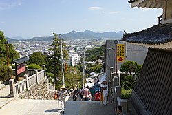
Yashima, the island on which the Battle of Yashima was fought

Ritsurin Garden
Teshima Island
- Shima Kitchen
- Teshima Art Museum

Based on its ancient name, Sanuki, Kagawa is famous for its Sanuki udon (wheat noodles). Recent years have seen an interest in Sanuki udon across Japan[citation needed], and many Japanese now take day-trips to taste the many Sanuki udon restaurants in Kagawa.
Transportation
Railroad
JR Shikoku
- Honshi-Bisan Line
- Yosan Line
- Dosan Line
- Kotoku Line
- Kotoden (Takamatsu Kotohira Electric Railroad)
- Kotohira Line
- Shido Line
- Nagao Line
Bus
Departure from Takamatsu
- Tokyo Station
Shinjuku of Tokyo- Tokyo Disneyland
- Hachioji
- Yokohama
- Nagoya
- Kyoto Station
Osaka
- Umeda
- Nanba
- Kansai Int'l Airport
Kobe
- Sannomiya
- Maiko Bus Stop
- Tokushima
- Kōchi
- Matsuyama
- Yawatahama
- Hiroshima
Fukuoka
- Kokura Station
- Hakata Station
- Tenjin Station
Road
Expressway
- Seto Chuo Expressway
- Takamatsu Expressway
- Matsuyama Expressway
National Highway
- Route 11 (Tokushima-Takamatsu-Marugame-Niihama-Maysuyama)
- Route 30
- Route 32 (Takamatsu-Kotohira-Kochi)
- Route 193
- Route 318
- Route 319
- Route 377
- Route 436
- Route 438
Port
Port of Takamatsu – Ferry route to Uno, Tonoshō (Shōdoshima Island), Kobe, Naoshima- Port of Marugame
- Port of Tadotsu
- Port of Tonoshō – Ferry route to Okayama, Himeji, Kobe and Osaka.
Airport
- Takamatsu Airport
In popular culture
The novel Battle Royale by Koushun Takami was set in the fictional town of Shiroiwa ('Castle Rock') in the Kagawa Prefecture. Okishima, the fictional island on which much of the novel takes place is placed in the Seto Inland Sea. The manga also places Shiroiwa in Kagawa Prefecture, while the film moves Shiroiwa to Kanagawa Prefecture.
Takamatsu, Kagawa Prefecture is also the main setting of the book "Kafka on the Shore" by Haruki Murakami.
Kagawa Prefecture is also the setting of the anime Poco's Udon World, My Bride is a Mermaid, and Yuki Yuna is a Hero.
References
^ Nussbaum, Louis-Frédéric. (2005). "Kagawa prefecture" in Japan Encyclopedia, p. 446, p. 446, at Google Books
^ Nussbaum, "Takamatsu" at p. 934, p. 934, at Google Books.
^ Nussbaum, "Provinces and prefectures" at p. 780, p. 780, at Google Books.
^ Ikatachōshi Editing Committee, ed. (March 31, 1987). Ikatachōshi 伊方町誌 [Ikata Town History] (in Japanese). Town of Ikata, printed by DAI-ICHI HOKI Publishing..mw-parser-output cite.citation{font-style:inherit}.mw-parser-output q{quotes:"""""""'""'"}.mw-parser-output code.cs1-code{color:inherit;background:inherit;border:inherit;padding:inherit}.mw-parser-output .cs1-lock-free a{background:url("//upload.wikimedia.org/wikipedia/commons/thumb/6/65/Lock-green.svg/9px-Lock-green.svg.png")no-repeat;background-position:right .1em center}.mw-parser-output .cs1-lock-limited a,.mw-parser-output .cs1-lock-registration a{background:url("//upload.wikimedia.org/wikipedia/commons/thumb/d/d6/Lock-gray-alt-2.svg/9px-Lock-gray-alt-2.svg.png")no-repeat;background-position:right .1em center}.mw-parser-output .cs1-lock-subscription a{background:url("//upload.wikimedia.org/wikipedia/commons/thumb/a/aa/Lock-red-alt-2.svg/9px-Lock-red-alt-2.svg.png")no-repeat;background-position:right .1em center}.mw-parser-output .cs1-subscription,.mw-parser-output .cs1-registration{color:#555}.mw-parser-output .cs1-subscription span,.mw-parser-output .cs1-registration span{border-bottom:1px dotted;cursor:help}.mw-parser-output .cs1-hidden-error{display:none;font-size:100%}.mw-parser-output .cs1-visible-error{font-size:100%}.mw-parser-output .cs1-subscription,.mw-parser-output .cs1-registration,.mw-parser-output .cs1-format{font-size:95%}.mw-parser-output .cs1-kern-left,.mw-parser-output .cs1-kern-wl-left{padding-left:0.2em}.mw-parser-output .cs1-kern-right,.mw-parser-output .cs1-kern-wl-right{padding-right:0.2em}
^ "General overview of area figures for Natural Parks by prefecture" (PDF). Ministry of the Environment. Retrieved 19 August 2012.
External links
| Wikimedia Commons has media related to Kagawa prefecture. |
- Kagawa Prefecture English homepage
(in Japanese) Official Kagawa Prefecture Japanese homepage
- National Archives of Japan ... Kagawa map (1891)
Notes from Shikoku in English
Takamatsu (capital) | ||
| Core city |
| |
| Cities |
| |
| Districts |
| |
List of mergers in Kagawa Prefecture | ||
| Regions |
|  | |||||||||||||||
|---|---|---|---|---|---|---|---|---|---|---|---|---|---|---|---|---|---|
| 47 Prefectures |
| ||||||||||||||||
Coordinates: 34°16′N 133°57′E / 34.267°N 133.950°E / 34.267; 133.950
Authority control |
|
|---|


